


Live Street View
3.512.00 Reviews
App Specs
- Version
- 1.3.8
- Updated On
- License
- Free
- Downloads
- 100,000+
- Developer
- Cool IT Solutions
- Categories
- Maps & Navigation
- Platform
- Android
Screenshots
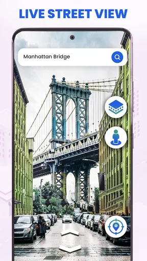
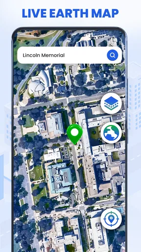
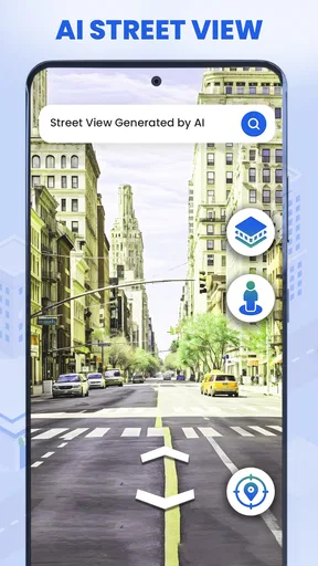
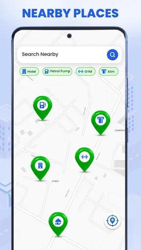
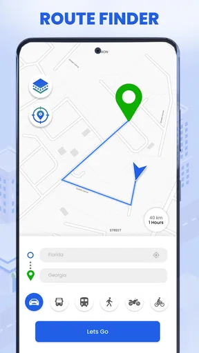
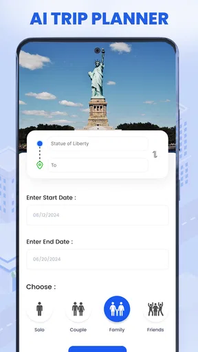
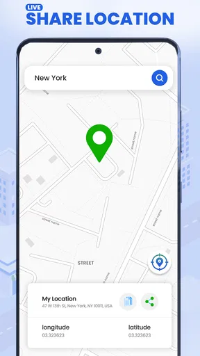
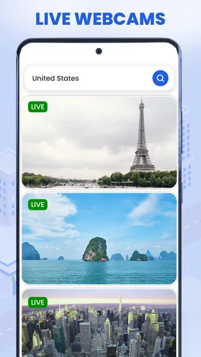
 Analysis by AppCompare
I approached Live Street View as a practical map companion rather than a replacement for a full navigation service. Its main appeal is visual: instead of relying only on a conventional map, I can explore street-level scenes, inspect a place before visiting, look around a destination, and switch to a three-dimensional globe view when I want broader geographic context. The addition of an AI trip planner and location sharing gives it a wider role, although the experience is still best when I treat those tools as planning aids rather than as the only source of travel information.
That distinction matters. A street-view app can be useful before I leave home, while walking through an unfamiliar neighborhood, or when I am trying to recognize the entrance to a building. It is a different kind of usefulness from turn-by-turn navigation. In my experience, the strongest reason to install this app is the ability to investigate a location visually and then pass that context to someone else. The weaker reason would be expecting a complete, polished replacement for every feature found in a dedicated navigation platform.
How I use Live Street View from the first search to the final plan
My baseline workflow starts with a simple question: what do I need to understand about this place? If I am checking a restaurant, hotel, station, or meeting point, I first search for the location and use the street view to examine the surrounding roads. I am not just looking at the destination itself. I check nearby corners, the direction of the road, adjacent buildings, and any visual landmarks that could make the final approach easier.
This is particularly helpful when an address looks clear on paper but may be confusing in person. A map pin can sit near several entrances, a large building can face a different street from the one listed in an invitation, or a pickup point can be difficult to identify after dark. Looking around in advance lets me form a visual memory. I can tell a friend, “look for the building beside the wide intersection,” rather than giving them another string of map instructions.
The globe view is useful for a different stage of planning. I use it when I want to understand how a destination fits into a larger route, compare regions, or explore an area without immediately narrowing my attention to one road. It feels more natural for browsing than for precise arrival planning. The transition from a broad world view to a specific street can also help when I am deciding whether a place is genuinely close to another destination or merely appears close on a flat map.
The AI trip planner adds another planning layer. I would use it to turn a loose idea into a possible itinerary, such as grouping several places in one outing or organizing stops around a general theme. I still review the result myself. An automated plan may be convenient for getting started, but personal priorities—opening times, mobility needs, preferred transport, weather, or how long I actually want to spend somewhere—can change the best order. The useful habit is to let the planner create a first draft, then verify every important stop visually and geographically.
Location sharing fits naturally at the end of this process. If I have checked a meeting place and want another person to see the same destination, sharing the location is more helpful than sending a vague description. I would use it for a family meetup, a travel group, or a friend arriving in an unfamiliar area. The important practical step is to share the specific place after checking it, not merely a nearby search result that happens to have a similar name.
Worth Reading Before You Choose

EA SPORTS FC Mobile 26 Is a Bigger Football Game, but It Takes Time

Flipboard Shows What News Apps Must Do Beyond the Feed

Switching to Android Auto Means Rethinking Your Driving Routine

Google Calendar Makes a Crowded Week Easier to Manage

Ludo King Makes the Most of the Minutes Between Plans

Baby Panda World Brings Quick Play to Modern Phones, but Its Game Library Feels Busy
A realistic everyday scenario
Imagine that I am meeting a friend at a café in a busy district. Before leaving, I search for the café, inspect the streets around it, and look for the side of the block where the entrance appears to be located. I then use the broader map context to see whether the nearest station exits on the same side of the road. Finally, I share the location with my friend and describe the visual landmark I noticed.
That workflow saves time in a way that ordinary map directions do not always manage. It is not about calculating a faster route every second. It is about reducing uncertainty at the last few minutes of a journey, when a person is already close but still does not know which entrance, corner, or frontage to use.
For travel planning, I would repeat the same process for each important stop. I would not inspect every street on a long itinerary, because that quickly becomes tedious. Instead, I would focus on arrival points, transfers, accommodation entrances, and places where the surrounding layout is likely to be confusing. This selective approach is faster and gives the visual tools a clear purpose.
Settings and habits worth checking
Because the app combines several visual and planning tools, I recommend spending a few minutes becoming familiar with its available controls before relying on it during a trip. The most important choice is not a hidden technical setting; it is deciding which view matches the task. Street-level imagery is best for recognizing an approach, while the globe view is better for geographic orientation. Switching deliberately between them prevents me from trying to solve every problem with one display.
I also keep the search target precise. When several places share a similar name, I check the surrounding streets and landmarks before sharing anything. This is an easy step to skip, especially when I am in a hurry, but it is one of the most valuable habits in the app. A visually convincing result can still be the wrong branch or the wrong entrance if I accept the first match without checking its context.
The AI planner deserves a similar review habit. I would enter clear, realistic goals instead of a vague request containing too many unrelated preferences. Once it proposes a route, I would examine whether the stops make sense geographically and whether the sequence suits the way I intend to travel. The planner can help me move from an empty page to a usable outline, but I would not treat its first suggestion as a final itinerary.
Sharing should also be part of a repeatable routine. I first open the location I have actually checked, confirm that the displayed place matches my intended destination, and only then send it. If the meeting depends on a particular entrance or nearby landmark, I include that information in my message. The app handles the location context; a short human explanation handles the last piece of ambiguity.
One practical consideration is the app’s age and device support. It runs on Android devices using version 8.0 or later, which makes it accessible to many existing phones, though users with older hardware should still expect visual map features to be more demanding than a basic text-based map. I would test the app at home before a trip rather than installing it for the first time at the station or airport.
Faster patterns for repeat users
Experienced use is less about tapping quickly and more about repeating a sensible sequence. My preferred shortcut is to separate discovery from confirmation. First, I browse with the globe or a broad map perspective to understand the area. Then I move into street view only for the locations that matter. This avoids spending time inspecting every road when I only need confidence about a few arrival points.
A second useful pattern is to create a visual checklist for unfamiliar destinations. I look for the road shape, a prominent neighboring building, the likely entrance, and the direction from the nearest major approach. These details are more memorable than a long list of turn instructions. When I arrive, I compare what I see with that mental checklist instead of repeatedly reopening the app for every small decision.
For group outings, I combine the planner and sharing tools in stages. I use the planner to organize the broad idea, inspect the key stops manually, and share only the destinations that other people truly need. Sending every intermediate point can create clutter. Sharing the meeting place, the accommodation, and perhaps one important transfer point is usually clearer than sending an entire itinerary without explanation.
I also avoid treating street imagery as a live camera. The name Live Street View may encourage that expectation, but street-level map imagery should be understood as a visual reference for places and roads, not as a guarantee of what is happening at this exact moment. Construction, temporary closures, parked vehicles, seasonal displays, and changed entrances can make a scene look different. I use the imagery to recognize an area, then remain alert to current signs and local conditions.
Another efficient habit is to plan around uncertainty rather than around curiosity. Exploring the globe can be enjoyable, but before a real trip I focus on questions that affect the journey: where will I enter, what will I see from the road, and which nearby landmark can I use if the address is hard to spot? This keeps the app from becoming a time-consuming visual tour when what I really need is a dependable arrival strategy.
Where the app is genuinely strong
The clearest strength is the combination of visual exploration and practical sharing. Many map users understand a route only after they arrive. Here, I can prepare visually and communicate that preparation to someone else. That is valuable for travelers, parents coordinating pickups, people visiting large venues, and anyone who finds written directions less useful than recognizable surroundings.
The globe view gives the app a more exploratory character than a standard navigation screen. I can use it to understand distance and regional position before focusing on individual streets. This is especially pleasant when I am researching a trip or learning how several destinations relate to one another. It makes the app feel like a bridge between a map utility and a visual geography tool.
The AI trip planner is another advantage for users who know what they want to do but do not yet know how to arrange it. It can reduce the friction of starting an itinerary. I appreciate that kind of assistance when planning a short outing, because the hardest part is often turning a collection of ideas into a sequence. The feature becomes more useful when I treat it as a draft generator and combine it with my own checks.
Its free entry point also makes experimentation easy. The app is listed as free, with optional in-app purchases ranging from about one dollar and forty-nine cents to around thirty-five dollars per item. I would therefore begin with the basic experience and decide whether any paid option solves a problem I actually have. A free download is attractive, but the presence of purchases means I would pay attention to what is included before building a regular workflow around a premium capability.
Limits that matter before depending on it
The average rating is three and a half stars from around four hundred ratings, and that gives me a useful signal: the app has an audience, but it is not a universally polished experience. I would approach it as a developing tool rather than as an unquestioned authority for navigation. The developer is Cool IT Solutions, and the current version is 1.3.8, so the experience may continue to change as the app develops.
My biggest reservation is the difference between visual planning and live navigation. If I need dependable turn-by-turn guidance, traffic-aware decisions, transit details, or highly specialized route options, I would compare this app with an established navigation service before leaving. Live Street View is more compelling for seeing and understanding a destination than for managing every changing condition on the road.
The imagery itself also has a natural limitation: a visual scene can become outdated or fail to show a temporary change. I would never use an old-looking entrance image as proof that a business is open, that a road is accessible, or that a construction barrier is absent. For important appointments, I would verify current details through the relevant venue or local information source.
The AI planner has a similar boundary. It can help organize ideas, but it cannot know every personal constraint unless I provide them, and even then I would review the result. A traveler with strict accessibility requirements, a complicated public-transport journey, or a schedule that depends on current service changes may be better served by a specialist tool. The planner is most suitable when I want a sensible starting structure, not when a small mistake would disrupt the entire day.
I would also skip this app if my only need is a lightweight map for quick directions. The visual exploration tools are the reason to use it; if I never inspect streets, compare views, plan multiple stops, or share locations, a simpler map may feel faster. Likewise, users who dislike experimenting with several views may prefer a more focused navigation interface.
Who should install it
I recommend it to people who think spatially and like to prepare before traveling. It is a good fit for checking unfamiliar neighborhoods, previewing an accommodation’s surroundings, coordinating meeting points, and building a rough sightseeing plan. It is also useful for anyone who often has to explain a location to another person and wants more than a written address.
Families can use it to agree on a clear pickup point. Travelers can inspect the final approach to a hotel or attraction. Students moving around a new campus or city can use the street view as a recognition aid. Even local users may find it helpful when visiting a large venue with several roads and entrances.
I would be more cautious recommending it as the sole app for professional drivers, time-critical journeys, or complex transport planning. Those users usually need continuously updated operational information and highly dependable routing. This app can complement that setup by showing what a destination looks like, but it should not automatically replace the tool that handles the journey itself.
The Everyone content rating makes it suitable for a broad audience, and the Android requirement of version 8.0 or later covers many devices. Still, I would judge the experience on the specific phone, connection, and travel situation I plan to use. Visual map browsing can be comfortable at home but less convenient on a small screen while moving, so preparation remains the better use case.
My mastery verdict
After using Live Street View as a visual planning companion, I see its value in the small decisions that make travel less confusing. I can inspect a destination, understand its surroundings, build a first itinerary with the AI planner, and share a checked location with another person. The most effective approach is deliberate: broad globe view for orientation, street view for arrival details, manual review for important stops, and sharing only after confirming the exact place.
The app works best when it reduces uncertainty before the journey, not when it is asked to control every part of the journey. That is the trade-off I would explain to a friend. It offers more than a basic map for visual discovery, but it does not remove the need for current judgment, careful checking, or a dedicated navigation alternative when conditions change quickly.
With over one hundred thousand installs, it has clearly attracted meaningful interest, though its moderate rating suggests that expectations should stay realistic. I would try the free version first, learn how its views and planning tools fit my habits, and only consider an in-app purchase if it provides a clear benefit for my own use. For visual location research and shareable trip preparation, Live Street View is worth exploring. For live, precision-critical navigation, I would keep a more specialized option ready beside it.
Pros
- Explore panoramic street imagery from locations around the world.
- Simple map-based navigation makes finding places easy.
- Useful for previewing neighborhoods before visiting.
- Supports virtual exploration without needing to travel.
- Can help identify landmarks and nearby streets remotely.
Cons
- Image quality and coverage vary considerably by location.
- Some imagery may be outdated or unavailable in certain areas.
- Requires a stable internet connection for smooth viewing.
- Panoramic loading can use significant mobile data.
- Location details may not always be accurate or complete.
FAQs for Live Street View
What is Live Street View, and what can I use it for?
Live Street View is a map and location-exploration app designed to help users view streets, landmarks, and surrounding areas through map imagery and panoramic street-level views. It can be useful for checking an unfamiliar destination before traveling, exploring neighborhoods remotely, planning routes, or identifying nearby places. The exact features and image coverage may vary depending on the selected location and available mapping data.
Does Live Street View show real-time images of streets?
Despite the word “Live” in its name, Live Street View generally should not be understood as a live video feed of every street. Most street-level imagery is captured in advance and may not represent current conditions, traffic, construction, weather, or business availability. Before relying on the app for navigation or travel decisions, users should verify important information with current maps, official sources, or local services.
Does Live Street View require an internet connection or access to my location?
An internet connection is normally required to load maps, street imagery, search results, and location information. The app may also request access to your device’s location to center the map on your position or help you explore nearby areas. Location permission is not always necessary for manually searching places, but denying it can limit certain functions. Review the requested permissions and enable only what you are comfortable using.
Is Live Street View free to download and use?
Live Street View may be available as a free download, but some versions can include advertising, optional purchases, subscriptions, or limits on particular tools and imagery. Pricing and available features can differ between Android and iOS, as well as by region and app version. Check the official store listing before installing, especially the in-app purchase section, to understand whether any premium features or recurring charges apply.
Is Live Street View accurate and safe to use for navigation?
The app can be helpful for visual orientation and exploring an area, but it should not be treated as the only source for turn-by-turn navigation or emergency information. Street imagery may be outdated, incomplete, blurred, or unavailable in some locations, while map data can change over time. Avoid interacting with the screen while driving, protect your personal information, and confirm critical directions using a reliable navigation service.


